Robot Vacuum Navigation Types Explained
You’ll choose navigation by matching your home and budget to sensor trade-offs: simple bump/IR and gyro systems are cheap but drift and miss coverage.
Camera vSLAM gives precise, semantic maps but needs light and raises privacy issues.
LiDAR yields fast, lighting-independent floor geometry for multi-room reliability.
Full SLAM fusion combines strengths for toughest layouts at higher cost.
Expect differences in coverage, rerouting, and map persistence. Keep going to see specific fit-for-home recommendations and feature checklists.
Quick Overview
- Sensor-based navigation uses bump, cliff, IR, and encoders for simple, low-cost coverage; however, it gives imprecise mapping and missed spots.
- Gyroscope/accelerometer dead-reckoning follows predictable patterns in small spaces; however, it accumulates drift and struggles in complex layouts.
- Camera-driven vSLAM builds real-time 3D or 2D maps for efficient routing; however, it has privacy and low-light limitations.
- LiDAR-based SLAM produces accurate, lighting-independent floorplans and robust localization; however, it comes at higher cost and complexity.
- Hybrid SLAM fuses camera, LiDAR, and encoders for robust mapping, loop closures, and adaptive rerouting in irregular, multi-room homes.
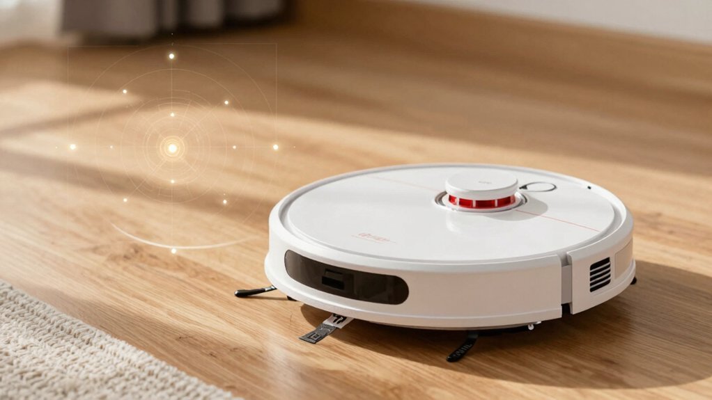
How does a robot vacuum know where it is and what it’s cleaning? You depend on an integrated stack: sensors (cameras, LiDAR, wheel encoders) feed SLAM algorithms that build and update maps while estimating pose. vSLAM uses RGB-D frames to generate 3D structure and semantic cues, whereas LiDAR supplies dense, lighting-independent scans for precise floorplan geometry.
The system continuously reconciles sensor input to perform loop closures; this reduces localization drift when you traverse familiar corridors. Mapping latency is critical: if map updates lag, planning degrades and coverage efficiency falls. You’ll see this in slower reroutes around moved furniture or delayed zone recognition.
Multi-map storage lets the robot switch floor contexts. Real-time planning overlays obstacle avoidance, zone cleaning, and return-to-charger behaviors on the current map. Privacy and power trade-offs govern sensor choice, but the technical objective remains the same: maintain an accurate, low-latency map and minimize pose error for optimal cleaning performance.
Want a quick rule-of-thumb for picking navigation? You should match navigation complexity to your floorplan complexity and budget, acknowledging broad limitations and clear cost considerations. For decision-making, evaluate coverage needs, light/privacy constraints, and multi-room efficiency.
- SLAM/LiDAR or hybrid AI: Choose if you need reliable, optimized coverage in cluttered, multi-room layouts. This option is despite higher cost considerations.
- Camera-based mapping: Pick when you want precise features and advanced routing. However, account for low-light performance and privacy trade-offs.
- Sensor-based systems: Select for constrained budgets and simple layouts. They’re economical, but accept reduced mapping precision and coverage gaps.
- Gyroscope/accelerometer: Opt for very simple, single-level homes where predictable patterns suffice. You should prioritize affordability over mapping.
Use this framework: If your home is complex and you need thorough cleaning, invest upward. If it’s simple or you’re cost-sensitive, prioritize sensor or gyro systems.
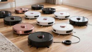
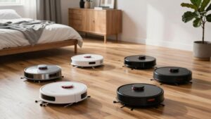
Although robot vacuums vary widely, their navigation systems fall into five clear categories: basic sensor arrays, gyroscope/accelerometer-based dead reckoning, camera-driven vSLAM, LiDAR scanning, and full SLAM sensor fusion. Each offers distinct trade-offs between cost, mapping precision, and environmental robustness.
You’ll see simple sensor-based units using bump, cliff, IR, and wheel encoders. They avoid hazards without map building, keeping costs low but path efficiency limited. Gyroscope/accelerometer systems perform dead reckoning to follow semi-structured patterns. They work in uncluttered, single-level homes but accumulate drift.
Camera-driven vSLAM (RGBD) recognizes features and performs real-time 3D map building for precise routing; yet, it needs light and raises privacy concerns. LiDAR units measure distances with laser scans to create accurate, darkness-capable 3D maps.
High-end SLAM fuses cameras, LiDAR, encoders, and other sensors via sensor fusion for loop closures and optimized paths. This increases computational demand and cost but yields the most robust, precise navigation.
How Each Type Works : Plain English Pros & Cons and “Best For
Curious which navigation style matches your home and cleaning priorities? You’ll get a clear, technical rundown of how each system works, its trade-offs, and where it’s most effective.
- Sensor-based: Uses cliff, wall, bump, and encoder inputs to react to obstacles. Pros: low cost, simple maintenance. Cons: imprecise coverage, inefficient in complex layouts. Best for budget-conscious, open-plan homes.
- Gyroscope/accelerometer: Tracks motion to follow semi-structured patterns without mapping. Pros: predictable in small, uncluttered spaces. Cons: drifts over time; no room mapping. Best for single-story, tidy flats.
- Camera/SLAM (camera-based pros): Builds visual maps for precise navigation and advanced features. Pros: efficient routes, room-level control. Cons: privacy issues, poor low-light performance; higher cost.
- LiDAR/SLAM: Uses laser ranging for highly accurate maps and obstacle avoidance. Pros: robust mapping, excellent coverage. Cons: peak cost; complexity. Best for complex, multi-room homes needing reliable, repeatable cleaning.
Which navigation system suits your home and budget depends on layout complexity, lighting, and how much you’re willing to pay for mapping accuracy and convenience.
If you live in a small, single-level apartment with predictable furniture, sensor-based or gyroscope-accelerometer navigation minimizes cost and complexity. You’ll accept less precise coverage but strong budget tradeoffs.
For moderately complex, multi-room homes where lighting is stable, camera-based systems give precise mapping and remote monitoring; this offers good accuracy but watch for privacy and reduced performance in low light.
In large or multi-floor households, LiDAR-based SLAM or hybrid multi-sensor solutions deliver reliable mapping, optimized paths, and multi-floor feasibility; however, these come at higher price points.
Hybrid AI systems combining LiDAR, cameras, and sensors are the technical optimum for irregular layouts and stairs. They balance redundancy and efficiency versus investment.
Choose by matching home topology, lighting conditions, and acceptable expenditure to the navigation modality’s operational strengths and known limitations.
Everyday Performance: Coverage, Obstacles, Getting Stuck, and Speed
Having matched navigation type to your home’s layout and budget, you’ll next evaluate everyday performance metrics that determine real-world usefulness: coverage completeness, obstacle handling, propensity to get stuck, and cleaning speed. You’ll compare deterministic coverage patterns from SLAM/LiDAR systems versus random-bounce strategies. The former creates straight, parallel cleaning lines that reduce misses; the latter risks gaps.
Sensor fusion and real-time obstacle handling let the system reroute around furniture, pets, and toys; this lowers collision and entanglement rates. Virtual boundaries and no-go zones cut stuck incidents by excluding tight gaps or under-furniture traps. Adaptive mapping (vSLAM plus multiple sensors) updates maps when furniture shifts, preserving coverage efficiency.
- Coverage patterns: straight parallel passes vs randomized sweeps and their miss rates
- Obstacle handling: sensor fusion, reroute logic, and collision mitigation
- Getting stuck: virtual barriers, gap detection, and recovery routines
- Speed: path optimization, reduced redundancy, and adaptive learning shortening runtime
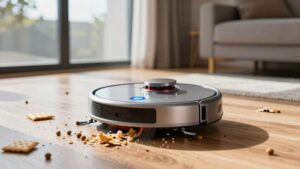
How does a robot translate a mapped route into reliable, real-world cleaning? You rely on integrated sensing and control: drop sensors prevent falls by detecting stairs or ledges and triggering immediate reversal. Wall and obstacle sensors maintain close, stable trajectories along boundaries and furniture. Carpet detection toggles suction and brush behavior when the robot transitions to rugs, optimizing pickup without manual intervention.
When battery drops, recharge & resume uses stored maps and navigation state to return to dock, recharge, then continue from the last position. This preserves coverage continuity. Sensor fusion and real-time adjustment combine inputs to reroute around unexpected obstacles and minimize missed zones.
For decision-making, use a one-page checklist: required features (drop sensors, carpet detection, reliable wall/obstacle sensing), navigation persistence (map retention, recharge & resume), adaptive control (sensor fusion, real-time rerouting), and validation (consistent coverage metrics, low bump rate).
Prioritize systems that demonstrably integrate these elements for dependable operation.
Frequently Asked Questions
How Often Do Maps Need Updating or Recalibration?
You should update maps whenever map accuracy degrades or after environmental changes. This typically occurs every 1–3 months; that’s your recalibration cadence. If you notice defective mapping, immediate recalibration is warranted.
Also, schedule recalibration after firmware updates, sensor replacements, or heavy traffic periods to counter sensor drift. Monitor error logs and localization confidence. Automate alerts for deviations beyond thresholds so you recalibrate proactively rather than reactively to maintain consistent navigation performance.
Yes, you can often share maps between robots, but capabilities vary by manufacturer and firmware. You’ll use sharing map features or cloud-backed map sync to enable cross-device coordination. This ensures each unit references the same floorplan and no-go zones.
Expect requirements like identical model families or compatible firmware, encrypted transfers, and occasional recalibration. Verify latency, conflict resolution, and map version control in the app to maintain consistent operation.
Firmware updates can alter navigation behavior by changing algorithms, sensor fusion, obstacle handling, and map interpretation. As a result, you’ll see different routing, speed, and edge-cleaning patterns.
They may enable improved map sharing protocols or change compatibility; this requires re-syncing or format conversion. You’ll need to update firmware consistently across devices for reliable shared maps. Otherwise, mismatches can cause localization drift, conflicting path planning, or failures in cooperative cleaning tasks.
What Privacy Risks Come From Camera- or Cloud-Based Mapping?
You face privacy risks when camera- or cloud-based mapping collects imagery and metadata that reveal room layouts, personal items, and activity patterns. Attackers or insiders could access maps. Vendors may retain data long-term under unclear policies.
You should assess data retention limits, encryption in transit and at rest, access controls, and deletion procedures. Disable cloud uploads or choose local-only mapping if you want stronger control over sensitive spatial data.
How Do Pets or Moving Furniture Affect Long-Term Mapping?
Pets and moving furniture degrade long-term mapping by introducing dynamic changes. Pet activity creates transient obstacles and false positives; furniture rearrangements produce persistent map mismatches. You’ll see more localization failures, frequent remapping, and higher path replanning costs.
Systems with adaptive SLAM, temporal filtering, and change detection will tolerate variability better. However, you’ll need periodic manual remaps or map-locking features to maintain navigation accuracy amid continual environmental changes.
Conclusion
You’ve seen how navigation shapes mapping, localization, and real-world performance. Now pick the system that matches your home and budget. If you need reliable, systematic cleaning and neat maps, favor LiDAR or SLAM. For tight budgets, gyroscope or sensor-based units give basic coverage but more misses.
Consider obstacles, stairs, pet hair, and recharge behavior when choosing. Prioritize recharge-and-resume, drop sensors, and carpet detection for consistent autonomy and fewer failures.