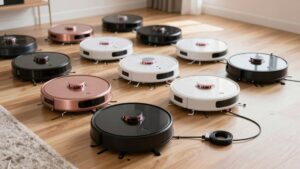
How Robot Vacuum Obstacle Avoidance Works
Your robot vacuum uses a layered sensor suite: LiDAR, ToF, structured‑light depth sensors, cameras, IR and ultrasonic proximity detectors, fused by onboard AI to build a spatial map, classify objects, and produce real‑time motion commands that slow, stop, or reroute to avoid collisions. Short‑range IR gives fine edge detection; ultrasonic offers early warning, and vision adds semantic recognition for cables or pet bowls.
It balances sensor confidence, latency, and suction control to act safely and efficiently. Keep going to see how each part works.
Quick Overview
- Robots use multiple sensors (LiDAR, ToF/depth, IR, ultrasonic, cameras) to detect obstacles and measure distances in real time.
- Sensor fusion aligns depth, camera, and proximity data into a probabilistic occupancy map to reduce false positives.
- Real-time control uses layered thresholds: close IR for fine avoidance; ultrasonic/ToF for early warnings and rerouting.
- Onboard AI classifies obstacles (furniture legs, cables, pets) and chooses actions: slow, stop, reroute, or gentle contact.
- Dirt sensors and mapping trigger targeted re-clean cycles while planning paths that avoid and adapt to moved objects.
Key Sensors That Let Robot Vacuums Sense Your Home
How do robot vacuums reliably navigate a home full of furniture, rugs, and toys? You rely on a sensor suite where each modality handles specific failure modes; you shouldn’t treat any single input as the sole truth. Infrared sensors give near-range edge and wall detection by emitting IR and timing reflections. They are simple, low-cost, and excel at close obstacles.
Ultrasonic sensors supplement IR by using sound echoes to detect objects that absorb or scatter light. Camera-based RGB or depth cameras enable object recognition and texture analysis; you use them for classification rather than raw ranging. More advanced units pair cameras with ToF or LiDAR for accurate depth data. ToF offers fast point distances in tight spots; LiDAR builds detailed maps for cluttered spaces.
Beware of treating an “irrelevant topic” like a nonexistent sensor as a substitute for real data. Navigation requires complementary sensors and sensor fusion to maintain robust obstacle avoidance.
Depth Sensors: LiDAR, ToF, and Structured Light Explained
Beyond the basic proximity and vision sensors you just read about, depth sensors provide the quantitative distance data that lets mapping and obstacle-avoidance algorithms reason about free space and object geometry. You rely on depth mapping from LiDAR, ToF, and structured light to convert raw returns into actionable 3D coordinates.
LiDAR rotates lasers to give high-precision, long-range point clouds; ToF measures pulse round-trip time for fast, real-time distance; structured light projects patterns to reconstruct fine surface topology at close range. Use sensor fusion to combine strengths: LiDAR’s range, ToF’s speed, and structured light’s detail. That fusion improves robustness against glare, reflectivity, and ambient noise. It also supports consistent local maps and obstacle classification.
| Sensor | Strength |
|---|---|
| LiDAR | Long-range, precise |
| ToF | Fast, real-time |
| Structured Light | Detailed, close-range |
| Fusion | Robust, complementary data |
What Cameras and Vision Systems Detect Beyond Shape and Distance
What else can camera systems tell you besides size and position? You’ll extract semantic and surface information: a camera provides color and texture cues that let algorithms classify objects (furniture, cords, slippers, pet waste) rather than just map geometry.
Dual RGB setups boost recognition and depth when fused with other sensors, improving detection of small or low-contrast items. You’ll also analyze texture and appearance to flag dirtier zones or specific surfaces; this enables targeted re-cleaning strategies.
Visual landmarks from cameras enrich 3D maps and complement LiDAR or ToF depth data to stabilize localization in feature-poor environments. When semantic models recognize interaction-prone items—pet bowls, charging cables—you’ll adapt navigation and path planning to avoid disturbance.
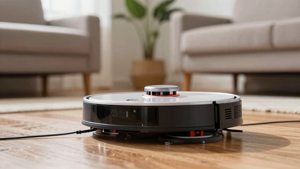
Proximity Sensors (IR, Ultrasonic) and How They Prevent Bumps and Falls
Curious how your robot avoids scraping furniture or tumbling down stairs? Infrared (IR) and ultrasonic proximity sensors provide the immediate distance data that prevents collisions and falls. IR emitters detect reflections within a few centimeters to approximately 10–20 cm, ideal for precise edge detection near walls and legs. Ultrasonic modules measure echo timing to sense obstacles from several centimeters up to a couple of meters for earlier avoidance.
Engineers optimize proximity sensor placement on the front and sometimes the sides to produce overlapping coverage ahead of motion. The sensors stream continuous distance measurements to the navigation controller, which executes real-time commands to slow, stop, or reroute. Accuracy and range determine safety margins at stairs and ledges. Manufacturers often deploy multiple sensors and apply bump prevention tuning algorithms to reduce false positives while preserving responsiveness.
You’ll see shorter detection thresholds for IR-based fine avoidance and longer ultrasonic thresholds for early warning. Together, they form a layered, time-critical defense against bumps and falls.
How Sensor Fusion Creates a Reliable Obstacle Map
How do multiple sensors combine to produce a single, reliable obstacle map? You fuse LiDAR depth maps, ToF/IR distance returns, and camera recognition into a common spatial frame via timestamped poses and calibration transforms. LiDAR supplies precise large-scale geometry; cameras add color/texture for classification. 3D structured light and ToF fill near-field gaps for tight spaces and small items.
Real-time processing performs sensor-specific noise reduction and dust removal filters. It then aligns point clouds and image features with pose estimation to mitigate false positives from any single modality. Probabilistic occupancy models weight inputs by confidence; transient IR spikes or motion-blurred frames do not corrupt the map.
The unified map supports segmentation that distinguishes furniture legs from cables and pets. It updates dynamically as obstacles move or appear. You get a concise, consistent spatial representation that enables robust path updates without relying on one sensor type.
AI Decisions: Speed, Accuracy, and How Recognition Becomes Movement
Why does a vacuum turn a visual recognition into an immediate motion change? You rely on onboard AI chips that evaluate detections in milliseconds, converting recognition into actuator commands. Multi-sensor fusion supplies depth, color, and residue inputs so the control loop classifies objects: furniture leg, cord, or pet waste. It then assigns a motion policy: reroute, slow, stop, or adjust suction.
You face speed challenges: decision latency and actuator response must stay below human-relevant thresholds to avoid collisions. You also manage accuracy tradeoffs: aggressive thresholds reduce false negatives but raise false positives, causing unnecessary stops. DirtSense modules quantify residue, triggering targeted re-cleaning or temporary suction boosts while the path planner recalculates trajectories.
The AI-driven control loop continuously updates predicted positions and issues smooth velocity profiles to maintain collision-free navigation. In practice, you balance computational load, sensor fidelity, and real-time constraints to convert perception into precise, timely movement.
Real-World Limits: Obstacles Modern Systems Can – and Can’t – Handle
Having shown how perception maps to immediate motion, we now examine what obstacles those control loops can and can’t handle in real environments. You’ll find modern systems reliably avoid walls, furniture legs, cables, and small objects like slippers by fusing LiDAR/ToF range data with cameras and IR. ToF and LiDAR give millimeter-level distance precision; cameras supply color and texture for classification, improving decisions in typical clutter.
However, edge case scenarios persist: transparent items, ultra-low-contrast objects, dark glossy surfaces, reflective materials, soft textiles, and deep shadows can confuse depth or be misclassified. Rapidly moving pets and very crowded floors with many small items can overwhelm real-time re-planning, forcing pauses or reduced speed. No single sensor dominates; integrated TOF+camera+IR plus onboard AI yields the best outcomes. You should still expect occasional failures and design for user friendly maintenance—clearing clutter and updating maps to keep control loops operating within their validated limits.
Choosing and Maintaining a Vacuum for Obstacle-Heavy Homes
What should you prioritize when your home is cluttered with cords, pet items, and tight furniture groupings? Choose multi-sensor systems (LiDAR, camera, ToF/IR) that detect varied obstacles in real time and deliver millimeter-level precision (~5 mm) to navigate under tables and around legs without collisions.
Prioritize models with AI driven suction that auto-adjusts power and with edge aware cleaning to prevent scattering debris near baseboards and pet zones. Confirm robust dirt sensing to trigger targeted re-clean cycles rather than broad passes.
Evaluate path-planning performance for fast re-planning when furniture or toys move during operation. Inspect maintenance and sensor calibration routines before purchase: lens cleaning, scheduled recalibration, and user-accessible sensor checks maintain detection fidelity in cluttered environments.
Finally, assess serviceability; replaceable sensors and clear error reporting reduce downtime. This ensures the vacuum sustains reliable obstacle avoidance and consistent cleaning in high-clutter homes.
Frequently Asked Questions
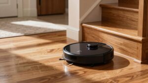
How Do Robot Vacuums Handle Stairs on Multi-Level Homes?
You’ll rely on cliff sensors to stop at stair edges. Stair detection prevents falls by sensing drops and reversing course. For multi-level homes, you’ll use multi level mapping to save separate floor plans. This lets the robot recall no-go zones and optimized routes per level.
You’ll manually carry the robot between floors or use elevator docks. Firmware combines sensor feedback and stored maps to ensure safe, efficient cleaning across levels.
Can Obstacle Avoidance Be Updated via Firmware or Over-The-Air Learning?
Yes, you can update obstacle avoidance via firmware updates and OTA learning. You’ll receive improved obstacle sensing algorithms and sensor fusion tweaks through firmware updates delivered over-the-air. These updates adjust thresholds, add mapped object libraries, and refine ML models using aggregated telemetry.
You’ll need network access and consent for data sharing. You’ll also get periodic calibration patches and behavioral telemetry opt-ins so your unit’s avoidance performance incrementally improves without manual hardware changes.
Yes, many models transmit obstacle data and use cloud sharing. You’ll find raw sensor readings, map updates, and tagged obstacles sent to manufacturers for processing, model improvement, and remote diagnostics.
Some devices share maps with linked household devices for coordinated cleaning. Check privacy settings: you can often disable cloud sharing or anonymize data. Vendors vary in retention, encryption, and opt-in requirements; so review policies before enabling cloud features.
How Do They Perform in Homes With Pets That Chase or Block Them?
They generally handle pet interaction variably; you’ll see improved obstacle response with higher-end models. You’ll want units with fast sensors and real-time mapping so they detect, slow, or reroute around chasing pets or stationary blockages.
In trials, you’ll observe pushback, pausing, or avoidance behaviors. Repeated interactions may retrain pet curiosity. Monitor logs if available to tune sensitivity and update firmware for better detection and evasion performance.
What Happens When Multiple Robot Vacuums Operate in the Same Space?
When multiple robot vacuums operate in the same space, they coordinate to avoid conflicts and optimize coverage. You’ll see multi robot coordination via task partitioning, collision avoidance, and dynamic path adjustments. They’ll exchange shared sensing data or centralize maps to maintain consistent localization and obstacle awareness.
If communication drops, each unit reverts to local sensing and conservative behaviors; this can reduce efficiency but still prevents frequent collisions and redundant cleaning.
Conclusion
You’ve seen how robot vacuums combine LiDAR, ToF, structured light, cameras, IR and ultrasonic proximity sensors, and sensor fusion to map and navigate your home. You’ll rely on AI to reconcile conflicting inputs, choose speed versus accuracy, and make real-time avoidance decisions.
Remember limits: soft, transparent, or tiny obstacles still fool systems. To get the best performance, pick models with multiple complementary sensors. Keep optics and sensors clean and unobstructed.